Madhya Pradesh will create an ecosystem for drone technology
Establishment of drone schools, image analytics, AI tools, curriculum development will be promoted

#MPPOSTBreaking
Madhya Pradesh will create an ecosystem for drone technology
Establishment of drone schools, image analytics, AI tools, curriculum development will be promoted
MPPOST, Bhopal : Saturday, February 8, 2025,
Madhya Pradesh will create an ecosystem for drone technology
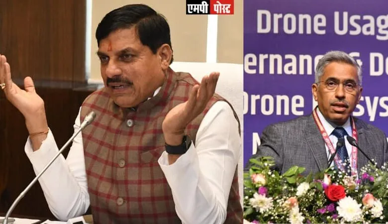
In order to promote use of drones Madhya Pradesh will soon set up a Drone Data Repository which will be a centralized platform for government drone data and imagery, inspired by the PM Gati Shakti initiative, according to the new Drone Policy recently cleared by the State Cabinet chaired by the Chief Minister Dr. Mohan Yadav.
Chief Minister Dr. Mohan Yadav has given instructions to concerning departments and agencies to make a comprehensive action plan to establish Madhya Pradesh as a leading hub for drone manufacturing and technology, fostering innovation, economic growth, and employment through the safe and efficient use of drones.
According to Additional Chief Secretary Science and Technology, Madhya Pradesh Government, Mr. Sanjay Dubey, the first state level workshop was held in Madhya Pradesh on the topic “Use of drones in governance and development of drone ecosystem in Madhya Pradesh” on 23 December 2024 to develop a better ecosystem for drone technology in the state and to discuss the drone policy. In which all the stakeholders and experts of the country discussed the wide applications of drone technology and also shared their suggestions for the drone policy.
The Department of Science and Technology, Government of Madhya Pradesh will be the nodal department for “Madhya Pradesh Drone Promotion and Use Policy-2025” and will be responsible for creating norms and maintaining rules for it.
Drone Data Repository will enhance data sharing and collaboration among various departments, utilizing GIS-based spatial planning and analytical tools for better visibility and monitoring.
The repository will enable real-time updates and dynamic monitoring, ensuring efficient resource allocation and optimized infrastructure development. Benefits include improved coordination, informed decision-making, cost and time efficiency, and enhanced project tracking.
Department of Science and Technology will ensure secure data management and controlled access while collaborating with stakeholders to maintain the repository’s accuracy and completeness.
The state government will ensure that all drone data collected by state agencies is handled and stored in accordance with data protection laws and regulations as per National Geospatial Policy 2022 or any subsequent amendments or policies. The state will promote the use of secure data storage and transmission technologies to safeguard sensitive information.
It may be mentioned here that use of Drones will increase faster in future. This Unmanned Aerial Vehicle (UAV), has revolutionized various industries by offering innovative solutions for a wide range of applications.
Their ability to capture real-time data, access hard-to-reach areas, and perform tasks with precision and efficiency makes them invaluable tools in modern technology. The following sections highlight some of the key use cases for drones, demonstrating their versatility and impact across different sectors. It is important to note that this list is not exhaustive, as the potential applications of drone technology continue to expand with ongoing advancements and innovations.
In Agriculture sector, it is used for crop monitoring. Drones are equipped with multispectral sensors can monitor crop health, detect diseases, and assess crop yields. Drones can apply fertilizers and pesticides precisely, reducing waste and environmental impact. They can identify areas that need more or less water, optimizing irrigation practices.
Besides, in case of disaster management, drones can quickly locate survivors in disaster-stricken areas using thermal imaging and high-resolution cameras. Drones can provide detailed images of affected areas, helping authorities prioritize recovery efforts and insurance claims. Drones can deliver medical supplies and food to inaccessible areas during emergencies.
Drones can inspect bridges, buildings, and other infrastructure for maintenance and safety assessments. Real-time updates on construction progress will now be possible. Drones can monitor wildlife populations and track movements without disturbing them. They can monitor forest health, detect illegal logging, and assess the impact of forest fires.
In order to foster a skilled workforce and promote the adoption of drone technology, the Madhya Pradesh under the new Drone Policy will establish drone schools with an investment through Public Private Partnership mode. The initiative aims to provide comprehensive training and education in drone technology, ensuring that students and professionals are well-equipped to meet the growing demands of the industry.
Polytechnics, ITIs, and engineering colleges will be promoted to develop curricula specific to drone/parts design, Drone image analytics, AI tools etc. Industry-Aligned Curricula: Develop training programs in collaboration with drone industry stakeholders to ensure the youth possess the skills required for employment in drone industry especially drone manufacturing, repair and assembling and data processing. Dedicated facilities for hands-on training, including flight simulators, drone maintenance workshops, and designated flying zones will b given.
It may be recalled here that with the launch of Digital India campaign, the drone sector has experienced transformative growth, driven by government policies, technological advancements, and increased funding. The global market is projected to grow from USD 71 billion in 2022 to USD 144 billion by 2030. The Indian drone market is expected to reach USD 13 Billion by 2030. Madhya Pradesh can position itself as a leader in drone technology, driving innovation and economic growth while ensuring the safe and responsible use of drones. This will contribute to the state’s vision of becoming a technologically advanced and economically prosperous region.


